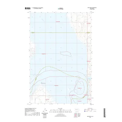
2020 Map of New Town SE
USGS Topo · Published 2020About this map
Lake Sakakawea dominates this landscape on the Missouri River, where the flooded valley creates a complex shoreline of points and bays. The map documents the vast expanse of the Van Hook Arm and the Missouri River channel as it winds through western North Dakota. Notable shoreline features include Independence Point and Lucky Mound Creek Bay, which mark the high-water margins of the reservoir. A singular roadway, BIA Rd 13, provides access to the southern reaches of the quadrangle near the boundary between Dunn and McLean counties. The map reflects a modern topography where the river's original path is largely submerged, leaving only the high ridges and bluffs as identifiable landmarks along the water's edge.
Find a feature on this map
15 named features on this map. Tap any name to fly to it.
Don’t see what you’re looking for? This feature index may not catch every label — zoom into the map to look around manually.
Map Details
Editions of this 2020 New Town SE Map
This is the sole edition of this map. No revisions or reprints were ever made.
Other maps of this area

1953 · Watford City
USGS Topo · 1:250,000

1957 · Watford City
USGS Topo · 1:250,000

1967 · Watford City
USGS Topo · 1:250,000

1967 · Raub NW
USGS Topo · 1:24,000

1967 · New Town SW
USGS Topo · 1:24,000

1967 · Parshall SW
USGS Topo · 1:24,000

1967 · New Town SE
USGS Topo · 1:24,000

1970 · String Buttes
USGS Topo · 1:24,000
1970 · Saddle Butte
USGS Topo · 1:24,000

1981 · New Town
USGS Topo · 1:24,000