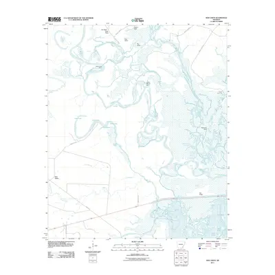
2011 Map of New Union
USGS Topo · Published 2011About this map
The confluence of the Ouachita River and Saline River dominates this landscape in southern Arkansas, where the winding river channels create a complex network of backwaters and oxbows. This 2011 survey illustrates how the water shapes the land, with distinct features like Stormhole Bend, Caney Marais Bend, and Staveyard Bend marking the river's meandering course. The low-lying basin is filled with numerous water bodies such as Pereogeethe Lake, Mud Lake, and Jones Lake, which are separated by localized elevations like Hogpen Ridge, Oak Ridge, and Pea Ridge.
Find a feature on this map
33 named features on this map. Tap any name to fly to it.
Don’t see what you’re looking for? This feature index may not catch every label — zoom into the map to look around manually.
Map Details
Editions of this 2011 New Union Map
This is the sole edition of this map. No revisions or reprints were ever made.
Other maps of this area

1933 · Strong
USGS Topo · 1:62,500

1934 · Ingalls
USGS Topo · 1:48,000

1934 · Felsenthal
USGS Topo · 1:62,500

1934 · Moro Bay
USGS Topo · 1:62,500

1937 · Strong
USGS Topo · 1:62,500

1937 · Felsenthal
USGS Topo · 1:62,500

1937 · Ingalls
USGS Topo · 1:62,500

1938 · Felsenthal
USGS Topo · 1:62,500

1938 · Moro Bay
USGS Topo · 1:62,500

1939 · Felsenthal
USGS Topo · 1:62,500