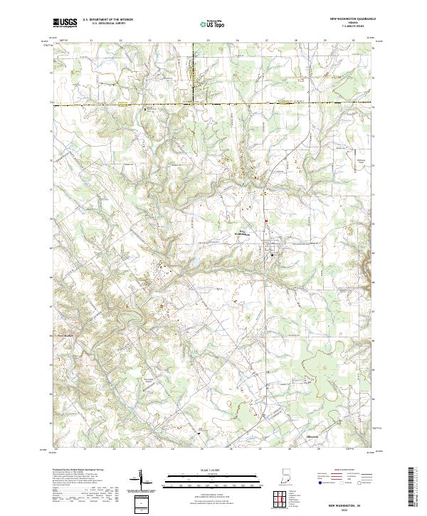
2022 Map of New Washington
USGS Topo · Published 2022About this map
New Washington serves as the central hub of this Indiana landscape, where the confluence of several rural routes including Kettle Bottom Rd and Nabb New Washington Rd W meet. The terrain is defined by the deep incisions of Fourteenmile Creek and its tributaries, such as East Fork Fourteenmile Creek and Flag Run, which carve through the farmland. Local history and genealogy are anchored by several established burial grounds, including Crown Hill Cem near the town center and the more secluded Barnes Community Cem to the northwest. To the south, the small settlement of Hibernia sits near the banks of Bull Cr. The presence of Twin Lakes Airport and Holloway Field indicates a reliance on small-scale aviation within this largely agricultural region straddling the borders of Scott, Jefferson, and Clark counties.
Find a feature on this map
88 named features on this map. Tap any name to fly to it.
Don’t see what you’re looking for? This feature index may not catch every label — zoom into the map to look around manually.
Map Details
Editions of this 2022 New Washington Map
This is the sole edition of this map. No revisions or reprints were ever made.
Other maps of this area

1905 · Prospect
USGS Topo · 1:62,500

1912 · Prospect
USGS Topo · 1:62,500

1932 · La Grange
USGS Topo · 1:62,500

1937 · Charlestown
USGS Topo · 1:24,000

1938 · Owen
USGS Topo · 1:24,000

1939 · Bethlehem
USGS Topo · 1:24,000

1939 · Madison West
USGS Topo · 1:24,000

1948 · Bethlehem
USGS Topo · 1:24,000

1948 · Madison West
USGS Topo · 1:24,000

1948 · Owen
USGS Topo · 1:24,000