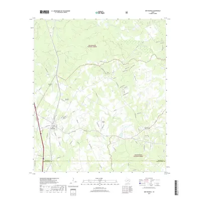
2019 Map of New Waverly
USGS Topo · Published 2019About this map
New Waverly sits at the intersection of farm roads and forest in East Texas, serving as a gateway to the southern reaches of the Sam Houston National Forest. The landscape is a dense network of creek drainages including Gourd Creek, Little Caney Creek, and Winters Bayou. For genealogists, the map is remarkably dense with family-named burial sites such as Mitchell Cemetery, Elmina Cemetery, and Jasper Cemetery, which are tucked away near the Hawthorne settlement and along Caney Creek. To the north, the terrain transitions into the national forest boundary where Griffin Lake and Walker Lake provide significant water features. The southeastern portion of the map reveals the transition from Walker County into Montgomery County, marked by timberlands and small clearings for residential development like Estates Airpark.
Find a feature on this map
83 named features on this map. Tap any name to fly to it.
Don’t see what you’re looking for? This feature index may not catch every label — zoom into the map to look around manually.
Map Details
Editions of this 2019 New Waverly Map
This is the sole edition of this map. No revisions or reprints were ever made.
Other maps of this area

1954 · Beaumont
USGS Topo · 1:250,000

1957 · Beaumont
USGS Topo · 1:250,000

1958 · Lake Paula
USGS Topo · 1:24,000

1959 · Moore Grove
USGS Topo · 1:24,000

1959 · Conroe NE
USGS Topo · 1:24,000

1960 · Willis
USGS Topo · 1:24,000

1960 · Maynard
USGS Topo · 1:24,000

1960 · New Waverly
USGS Topo · 1:24,000

1960 · Phelps
USGS Topo · 1:24,000

1961 · Oakhurst
USGS Topo · 1:24,000