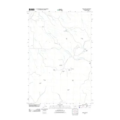
2011 Map of New Year
USGS Topo · Published 2011About this map
The settlement of New Year sits at the heart of this Fergus County landscape, where the foothills meet the drainages of the Judith Mountains. This 2011 survey captures the area's rural character and complex topography, defined by high points like New Year Peak and Pyramid Peak. Water management and land use are evident through features such as the Limpke Number 2 Dam and the Maiden Fur Farm, while transportation is facilitated by the Maiden Rd and the Maiden Cutoff.
Find a feature on this map
30 named features on this map. Tap any name to fly to it.
Don’t see what you’re looking for? This feature index may not catch every label — zoom into the map to look around manually.
Map Details
Editions of this 2011 New Year Map
This is the sole edition of this map. No revisions or reprints were ever made.
Other maps of this area

1941 · Lewistown
USGS Topo · 1:62,500

1941 · Judith Peak
USGS Topo · 1:62,500

1944 · Lewistown
USGS Topo · 1:62,500

1944 · Judith Peak
USGS Topo · 1:62,500

1954 · Lewistown
USGS Topo · 1:250,000

1959 · Lewistown
USGS Topo · 1:250,000

1978 · Lewistown
USGS Topo · 1:100,000
1985 · Kendall
USGS Topo · 1:24,000

1985 · Hilger
USGS Topo · 1:24,000

1985 · Armells
USGS Topo · 1:24,000