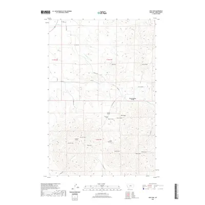
2020 Map of New Year
USGS Topo · Published 2020About this map
The Judith Mountains dominate this Fergus County landscape, where the settlement of New Year sits at the head of a complex system of gulches and canyons. The terrain is marked by significant vertical relief, rising toward prominent summits like New Year Peak, Porphyry Peak, and Pyramid Peak. This area is historically defined by its drainage and access routes, with Warm Spring Creek and Muskrat Cr carving deep paths through the foothills, while the Maiden Rd and Maiden Cutoff provide the primary transit through the upland passes.
Find a feature on this map
38 named features on this map. Tap any name to fly to it.
Don’t see what you’re looking for? This feature index may not catch every label — zoom into the map to look around manually.
Map Details
Editions of this 2020 New Year Map
This is the sole edition of this map. No revisions or reprints were ever made.
Other maps of this area

1941 · Lewistown
USGS Topo · 1:62,500

1941 · Judith Peak
USGS Topo · 1:62,500

1944 · Lewistown
USGS Topo · 1:62,500

1944 · Judith Peak
USGS Topo · 1:62,500

1954 · Lewistown
USGS Topo · 1:250,000

1959 · Lewistown
USGS Topo · 1:250,000

1978 · Lewistown
USGS Topo · 1:100,000
1985 · Kendall
USGS Topo · 1:24,000

1985 · Hilger
USGS Topo · 1:24,000

1985 · Armells
USGS Topo · 1:24,000