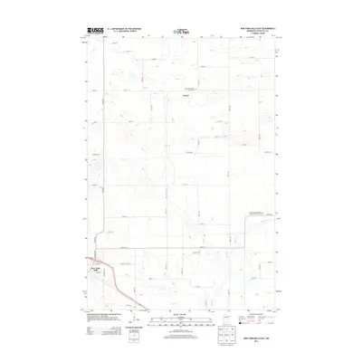
2013 Map of New York Mills East
USGS Topo · Published 2013About this map
New York Mills sits at the southwestern edge of this survey, where the intersection of Us-10 and N Broadway marks a local hub of transit and commerce. The surrounding Otter Tail County landscape is characterized by a grid of rural routes, including Co HWY-56 and Co HWY-67, that connect family farms and local landmarks. Notable spiritual and genealogical sites are prominent, such as Nazareth Lutheran Church and Saint Peter's Norwegian Lutheran Church, both of which include associated cemeteries like the Saint Peter's Norwegian Lutheran Church Cem. The terrain is defined by the subtle drainage patterns of Bluff Cr and Blue Cr, which wind through the northern and eastern portions of the quadrangle. In the center, the small settlement of Davies serves as a waypoint among the section lines, illustrating the enduring agricultural layout of this part of Minnesota.
Find a feature on this map
43 named features on this map. Tap any name to fly to it.
Don’t see what you’re looking for? This feature index may not catch every label — zoom into the map to look around manually.
Map Details
Editions of this 2013 New York Mills East Map
This is the sole edition of this map. No revisions or reprints were ever made.
Other maps of this area

1953 · Brainerd
USGS Topo · 1:250,000

1957 · Brainerd
USGS Topo · 1:250,000

1958 · Brainerd
USGS Topo · 1:250,000

1965 · Brainerd
USGS Topo · 1:250,000

1969 · Sebeka SW
USGS Topo · 1:24,000

1969 · New York Mills NW
USGS Topo · 1:24,000

1969 · Sebeka NW
USGS Topo · 1:24,000

1969 · Heinola
USGS Topo · 1:24,000

1969 · New York Mills West
USGS Topo · 1:24,000

1969 · Wadena
USGS Topo · 1:24,000