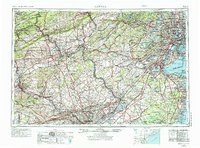
1944 Map of Newark
USGS Topo · Published 1974About this map
The industrial corridor and coastal wetlands of the Mid-Atlantic are extensively detailed in this mid-century survey, spanning from Philadelphia and Reading across the Delaware River to New York harbor. The map documents a dense network of transit and commerce, including the Pennsylvania Railroad and the emerging New Jersey Turnpike, which would soon reshape the region's geography. Key academic and military institutions are prominent, from Princeton University and Rutgers University to critical defense sites like Fort Dix and the Lakehurst Naval Air Station.
Find a feature on this map
372 named features on this map. Tap any name to fly to it.
Don’t see what you’re looking for? This feature index may not catch every label — zoom into the map to look around manually.
Map Details
Editions of this 1944 Newark Map
5 editions found

Other maps of this area

1884 · Whitings
USGS Topo · 1:62,500

1888 · Franklin
USGS Topo · 1:62,500

1888 · Plainfield
USGS Topo · 1:62,500

1888 · Bordentown
USGS Topo · 1:62,500

1888 · Pemberton
USGS Topo · 1:62,500

1888 · Barnegat
USGS Topo · 1:62,500

1888 · Morristown
USGS Topo · 1:62,500

1888 · Hackettstown
USGS Topo · 1:62,500

1888 · New Brunswick
USGS Topo · 1:62,500

1888 · Mount Holly
USGS Topo · 1:62,500