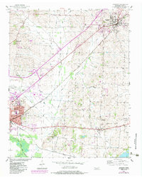
1952 Map of Newbern
USGS Topo · Published 1983About this map
Newbern and Dyersburg anchor this West Tennessee landscape during a period of transition, where the Illinois Central railroad still defines the local logistics and settlement pattern. Small rural communities like Roellen, Viar, and Bishop are documented alongside family-named landmarks and institutions that served the agricultural hinterland. The map reveals a dense network of local education and faith, including the Jennie Bell School, Neal Thomas School, and Church Grove Ch, providing critical spatial context for genealogists. The terrain is shaped by the North Fork Forked Deer River and its various tributaries like Light Creek and Jones Creek, which carve through the Dyer County countryside. 1980s-era revisions in purple highlight the growth of transportation infrastructure, notably Interchange 15, and the expansion of residential and commercial zones near the larger town centers.
Find a feature on this map
45 named features on this map. Tap any name to fly to it.
Don’t see what you’re looking for? This feature index may not catch every label — zoom into the map to look around manually.
Map Details
Editions of this 1952 Newbern Map
2 editions found
Other maps of this area

1939 · Dyersburg
USGS Topo · 1:62,500

1939 · Halls
USGS Topo · 1:62,500

1952 · Bonicord
USGS Topo · 1:24,000

1952 · Newbern
USGS Topo · 1:24,000

1952 · Lane
USGS Topo · 1:24,000

1952 · Dyersburg
USGS Topo · 1:24,000

1952 · Miston
USGS Topo · 1:24,000

1952 · Fowlkes
USGS Topo · 1:24,000

1956 · Dyersburg
USGS Topo · 1:250,000

1956 · Blytheville
USGS Topo · 1:250,000