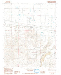
1982 Map of Newberry Springs
USGS Topo · Published 1993About this map
Newberry Springs serves as the focal point for this high-desert survey, situated at the base of the dramatic Newberry Mountains. The map illustrates the region's transition from the flat Mojave Valley in the north to the complex geologic structures of the south, including extensive Lava flows and the Rodman Mountains. Local industry and infrastructure are well-documented, with an Underground Gas Pipeline traversing the valley floor alongside a Quarry and Gravel Pit. Of particular interest to desert historians is the location of Newberry Spring (Dry) and the Newberry Cairn, which stands as a prominent landmark on Newberry Peak. The landscape is further defined by seasonal drainage patterns like Kane Wash, highlighting the arid character of this San Bernardino County locale in the early 1980s.
Find a feature on this map
19 named features on this map. Tap any name to fly to it.
Don’t see what you’re looking for? This feature index may not catch every label — zoom into the map to look around manually.
Map Details
Editions of this 1982 Newberry Springs Map
2 editions found
Other maps of this area

1953 · San Bernardino
USGS Topo · 1:250,000

1953 · Yermo
USGS Topo · 1:24,000

1955 · Silver Bell Mine
USGS Topo · 1:24,000

1955 · Newberry
USGS Topo · 1:62,500

1955 · Ord Mountains
USGS Topo · 1:62,500

1955 · Rodman Mountains
USGS Topo · 1:62,500

1956 · San Bernardino
USGS Topo · 1:250,000

1956 · Daggett
USGS Topo · 1:62,500

1957 · San Bernardino
USGS Topo · 1:250,000

1958 · San Bernardino
USGS Topo · 1:250,000