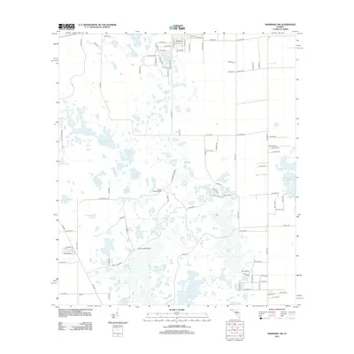
2012 Map of Newberry SW
USGS Topo · Published 2012About this map
Haven Winquipin and the small settlement of Newton anchor this part of Alachua County, characterized by a complex network of sinkhole lakes and wetlands. The landscape is defined by its many distinctive water bodies, ranging from the prominent Waccasassa Lake and Door Shutter Lake to curiously named features like Mineral Feeder Pond, Meeting Pond, and Watermelon Pond. These features suggest a karst topography where water levels and connectivity between basins shape the local environment.
Find a feature on this map
103 named features on this map. Tap any name to fly to it.
Don’t see what you’re looking for? This feature index may not catch every label — zoom into the map to look around manually.
Map Details
Editions of this 2012 Newberry SW Map
This is the sole edition of this map. No revisions or reprints were ever made.
Other maps of this area

1954 · Chiefland
USGS Topo · 1:24,000

1954 · Bronson
USGS Topo · 1:24,000

1954 · Gainesville
USGS Topo · 1:250,000

1955 · Bronson NE
USGS Topo · 1:24,000

1958 · Gainesville
USGS Topo · 1:250,000

1959 · Gainesville
USGS Topo · 1:250,000

1968 · Newberry SW
USGS Topo · 1:24,000

1968 · Waters Lake
USGS Topo · 1:24,000
1968 · Archer
USGS Topo · 1:24,000

1968 · Newberry
USGS Topo · 1:24,000