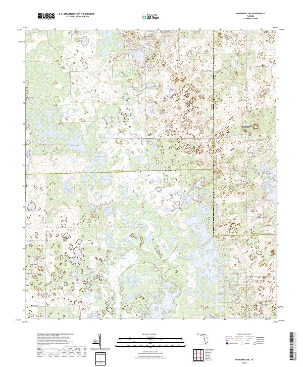
2024 Map of Newberry SW
USGS Topo · Published 2024About this map
The Waccasassa River originates amidst a complex network of wetlands and shallow basins where Levy County meets Alachua and Gilchrist. This landscape is defined by its distinct hydrography, featuring numerous named ponds and lakes that suggest a karst topography common to this region. Large water bodies such as Waccasassa Lake, Dogshutter Lake, and the cluster of Watermelon Ponds dot the terrain, linked by obscure drainage patterns and springs like Sawgrass Springs.
Find a feature on this map
74 named features on this map. Tap any name to fly to it.
Don’t see what you’re looking for? This feature index may not catch every label — zoom into the map to look around manually.
Map Details
Editions of this 2024 Newberry SW Map
This is the sole edition of this map. No revisions or reprints were ever made.
Other maps of this area

1954 · Chiefland
USGS Topo · 1:24,000

1954 · Bronson
USGS Topo · 1:24,000

1954 · Gainesville
USGS Topo · 1:250,000

1955 · Bronson NE
USGS Topo · 1:24,000

1958 · Gainesville
USGS Topo · 1:250,000

1959 · Gainesville
USGS Topo · 1:250,000

1968 · Newberry SW
USGS Topo · 1:24,000

1968 · Waters Lake
USGS Topo · 1:24,000
1968 · Archer
USGS Topo · 1:24,000

1968 · Newberry
USGS Topo · 1:24,000