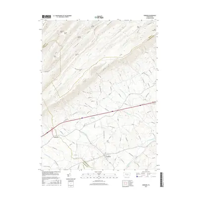
2016 Map of Newburg
USGS Topo · Published 2016About this map
Newburg and McKinney anchor the agricultural and valley corridors of this 2016 survey, where the borders of Franklin, Cumberland, and Perry Counties converge. The landscape is defined by the parallel ridges of Amberson Ridge, Sherman Mtn, and Blue Mountain, creating the deep Gunter Valley and numerous named gaps like the First Narrows and Second Narrows. The hydrology of the region is complex, with Conodoguinet Creek flowing through the southern lowland while various runs, including Laughlin Run and Newburg Run, drain the slopes of Mid Ridge. Genealogists may find interest in Hanna Cem and the various family-named roads that suggest long-standing land tenures. Modern infrastructure like the Interstate 76 corridor bisects the terrain, contrasting with older landmarks like Old Saw Mill Ln and Covered Bridge Rd, reflecting the evolution of rural Pennsylvania transportation.
Find a feature on this map
98 named features on this map. Tap any name to fly to it.
Don’t see what you’re looking for? This feature index may not catch every label — zoom into the map to look around manually.
Map Details
Editions of this 2016 Newburg Map
This is the sole edition of this map. No revisions or reprints were ever made.
Other maps of this area

1919 · Newville
USGS Topo · 1:62,500

1919 · Mattawana
USGS Topo · 1:62,500

1923 · Shippensburg
USGS Topo · 1:62,500

1930 · Loysville
USGS Topo · 1:62,500

1933 · Loysville
USGS Topo · 1:62,500

1936 · East Waterford
USGS Topo · 1:48,000

1941 · East Waterford
USGS Topo · 1:62,500

1943 · Shippensburg
USGS Topo · 1:62,500

1945 · Newville
USGS Topo · 1:62,500

1945 · Shippensburg
USGS Topo · 1:62,500
Featured Places
- Lurgan Township, PA
- Newburg, Hopewell Township
- Jackson Township, PA
- North Newton Township, PA
- Lower Mifflin Township, PA