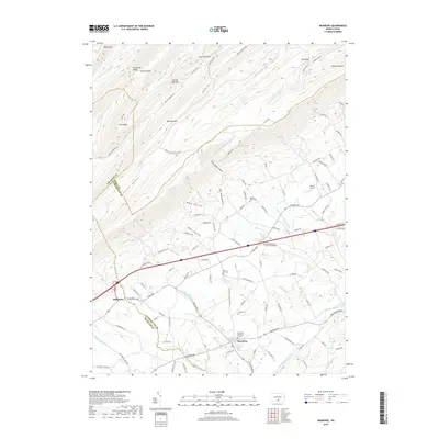
2019 Map of Newburg
USGS Topo · Published 2019About this map
Newburg and Mckinney anchor the southern landscape where the Cumberland Valley begins its ascent into the ridges of the Appalachians. This terrain is defined by the high crests of Amberson Ridge and Blue Mountain, separated by deep gaps like First Narrows and Second Narrows. The drainage pattern is intricate, with Conodoguinet Creek and its many tributaries, including Peebles Run and Bore Mill Run, carving through the limestone valley floor. For genealogists, the map is particularly detailed regarding local burial sites, documenting the Newburg Church of God Cem, the Zion Reformed Church Graveyard, and family-named plots such as the Hoover-Bert Cem. The northern portion of the map transitions into more isolated hollows like Wasp Hollow and Three Square Hollow, showing the intersection of agricultural valley life and the forested slopes of the Perry County line.
Find a feature on this map
115 named features on this map. Tap any name to fly to it.
Don’t see what you’re looking for? This feature index may not catch every label — zoom into the map to look around manually.
Map Details
Editions of this 2019 Newburg Map
This is the sole edition of this map. No revisions or reprints were ever made.
Other maps of this area

1919 · Newville
USGS Topo · 1:62,500

1919 · Mattawana
USGS Topo · 1:62,500

1923 · Shippensburg
USGS Topo · 1:62,500

1930 · Loysville
USGS Topo · 1:62,500

1933 · Loysville
USGS Topo · 1:62,500

1936 · East Waterford
USGS Topo · 1:48,000

1941 · East Waterford
USGS Topo · 1:62,500

1943 · Shippensburg
USGS Topo · 1:62,500

1945 · Newville
USGS Topo · 1:62,500

1945 · Shippensburg
USGS Topo · 1:62,500
Featured Places
- Lurgan Township, PA
- Newburg, Hopewell Township
- Jackson Township, PA
- North Newton Township, PA
- Lower Mifflin Township, PA