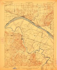
1905 Map of Newburg
USGS Topo · Published 1921About this map
The confluence of the Green River and the Ohio River defines this early twentieth-century landscape, capturing a period when river traffic and nascent rail lines dictated the region's development. On the Indiana side, the Evansville Suburban and Newburg transit line connects the riverbank settlement of Newburg to the surrounding rural townships of Knight and Anderson. Across the water in Kentucky, the topography becomes more pronounced, with the Green River winding past Spottsville and Bluff City.
Find a feature on this map
54 named features on this map. Tap any name to fly to it.
Don’t see what you’re looking for? This feature index may not catch every label — zoom into the map to look around manually.
Map Details
Editions of this 1905 Newburg Map
3 editions found
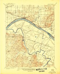
Other maps of this area

1900 · De Gonia Springs
USGS Topo · 1:62,500

1901 · Owensboro
USGS Topo · 1:62,500

1901 · Haubstadt
USGS Topo · 1:62,500

1902 · Ditney
USGS Topo · 1:125,000

1902 · Degonia Springs
USGS Topo · 1:62,500

1902 · Boonville
USGS Topo · 1:62,500

1903 · Haubstadt
USGS Topo · 1:62,500

1903 · Patoka
USGS Topo · 1:125,000

1905 · Newburg
USGS Topo · 1:62,500

1906 · Sebree
USGS Topo · 1:62,500