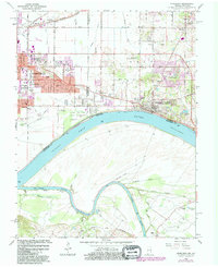
1964 Map of Newburgh
USGS Topo · Published 1981About this map
Angel Mounds State Memorial and its preserved Indian Mounds anchor the northern bank of the Ohio River on this Indiana and Kentucky border survey. The landscape reflects a mid-century transition from established riverside communities like Newburgh and Smythe to the suburban expansion of Evansville, visible in the commercial clusters of Lawndale and Washington Square Shopping Center. This era of growth is further marked by religious and educational centers such as St Michaels Ch, Holy Rosary Sch, and Castle High Sch in the Paradise vicinity.
Find a feature on this map
53 named features on this map. Tap any name to fly to it.
Don’t see what you’re looking for? This feature index may not catch every label — zoom into the map to look around manually.
Map Details
Editions of this 1964 Newburgh Map
Other maps of this area

1901 · Haubstadt
USGS Topo · 1:62,500

1902 · Ditney
USGS Topo · 1:125,000

1902 · Boonville
USGS Topo · 1:62,500

1903 · Haubstadt
USGS Topo · 1:62,500

1903 · Patoka
USGS Topo · 1:125,000

1905 · Newburg
USGS Topo · 1:62,500

1914 · Henderson
USGS Topo · 1:48,000

1916 · Henderson
USGS Topo · 1:62,500

1951 · Yankeetown
USGS Topo · 1:24,000

1951 · Spottsville
USGS Topo · 1:24,000