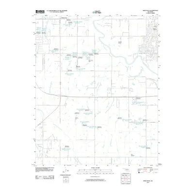
2010 Map of Newcastle
USGS Topo · Published 2010About this map
Newcastle and its surrounding rural landscapes are defined by the winding course of the Canadian River and an extensive network of petroleum extraction sites in the early 21st century. The map illustrates a transition from agrarian land use to industrial energy production, evidenced by the Southeast Newcastle Oil Field, North Lindsay Ridge Oil Field, and North Washington Oil Field. This period shows a complex hydrological system of small dams and reservoirs, such as Oknoname 087014 Reservoir and Oknoname 087057 Reservoir, which manage the drainage of tributaries like Marcy Creek and Boggy Creek. Genealogists may find interest in the Warren Cemetery near the northern boundary, while topographic landmarks like Mount Williams provide a sense of the local elevation. The transportation corridor is anchored by the H E Bailey Turnpike-Norman Spr, which links the growing residential developments of Newcastle to the broader regional infrastructure.
Find a feature on this map
88 named features on this map. Tap any name to fly to it.
Don’t see what you’re looking for? This feature index may not catch every label — zoom into the map to look around manually.
Map Details
Editions of this 2010 Newcastle Map
This is the sole edition of this map. No revisions or reprints were ever made.
Other maps of this area

1892 · Moore
USGS Topo · 1:62,500

1893 · Norman
USGS Topo · 1:62,500

1893 · Oklahoma City
USGS Topo · 1:62,500

1898 · Purcell
USGS Topo · 1:125,000

1904 · Chickasha
USGS Topo · 1:125,000

1925 · Norman NO 2
USGS Topo · 1:24,000

1934 · Moore
USGS Topo · 1:62,500

1936 · Norman
USGS Topo · 1:62,500

1938 · Moore
USGS Topo · 1:62,500

1954 · Oklahoma City
USGS Topo · 1:250,000