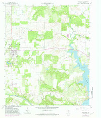
1964 Map of Newcastle
USGS Topo · Published 1982About this map
Newcastle and its surrounding coal-rich hills stand at the center of this mid-century survey, which reveals an economy defined by mineral extraction and water management. The map documents an extensive cluster of workings including Belknap Mine No 1 through Belknap Mine No 5, highlighting the town's historical reliance on mining. Further south, Fort Belknap Park marks the site of the frontier military outpost near the banks of the Brazos River.
Find a feature on this map
30 named features on this map. Tap any name to fly to it.
Don’t see what you’re looking for? This feature index may not catch every label — zoom into the map to look around manually.
Map Details
Editions of this 1964 Newcastle Map
2 editions found
Other maps of this area

1924 · Graham 4-d
USGS Topo · 1:48,000

1925 · Graham 4-c
USGS Topo · 1:48,000

1927 · Graham
USGS Topo · 1:62,500

1954 · Wichita Falls
USGS Topo · 1:250,000

1958 · Wichita Falls
USGS Topo · 1:250,000

1964 · Newcastle
USGS Topo · 1:24,000

1964 · True
USGS Topo · 1:24,000

1964 · Loving
USGS Topo · 1:24,000

1964 · Lake Eddleman
USGS Topo · 1:24,000

1964 · Olney
USGS Topo · 1:24,000