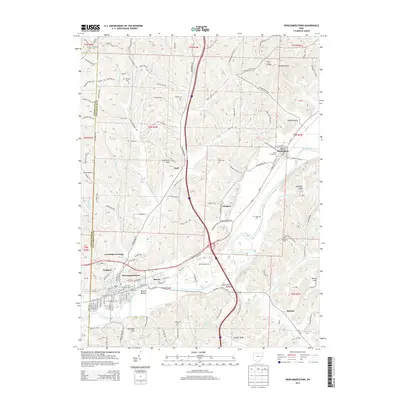
2013 Map of Newcomerstown
USGS Topo · Published 2013About this map
The Tuscarawas River carves a significant path through this landscape, serving as the historical anchor for industrial and transit hubs like Newcomerstown and Port Washington. These valley settlements grew along the river and the Ohio Central RR, which mirrors the water's course to support the region's movement of goods. The terrain rises sharply from Nugent Bottom and Stark Patent Bottom into high ridges and knobs, including Elephant Knob and the distinctive Umbrella Rock. Local history is deeply etched into the hills, visible through numerous burial grounds such as the Moravian Cem, Union Cemeteries, and State Street Cem. Smaller communities like Coalport and Glasgow suggest a past shaped by river-adjacent industries, while the upland areas near Bernice and Wolf maintain a more rural character defined by creeks like Buckhorn Cr and Wolf Cr.
Find a feature on this map
175 named features on this map. Tap any name to fly to it.
Don’t see what you’re looking for? This feature index may not catch every label — zoom into the map to look around manually.
Map Details
Editions of this 2013 Newcomerstown Map
This is the sole edition of this map. No revisions or reprints were ever made.
Other maps of this area

1909 · Antrim
USGS Topo · 1:48,000

1909 · Uhrichsville
USGS Topo · 1:62,500

1909 · Cambridge
USGS Topo · 1:62,500

1911 · Antrim
USGS Topo · 1:62,500

1911 · Uhrichsville
USGS Topo · 1:62,500

1911 · Newcomerstown
USGS Topo · 1:62,500

1912 · Cambridge
USGS Topo · 1:62,500

1913 · Newcomerstown
USGS Topo · 1:62,500

1943 · Newcomerstown
USGS Topo · 1:62,500

1951 · Canton
USGS Topo · 1:250,000