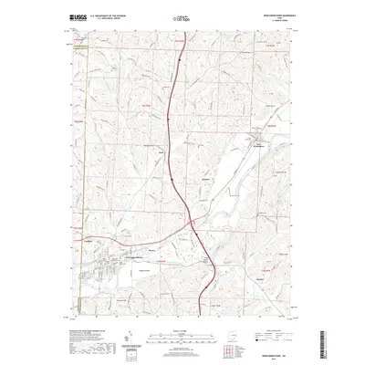
2019 Map of Newcomerstown
USGS Topo · Published 2019About this map
The Tuscarawas River carves a deep valley through this portion of eastern Ohio, dictating the settlement patterns of towns like Newcomerstown and Port Washington. The valley floor is characterized by expansive flats such as Nugent Bottom and Stark Patent Bottom, where agricultural and industrial activity has long been concentrated. Away from the river, the landscape rises into a network of ridges and hollows, including Stocker Ridge and Blue Ridge, with prominent landmarks like Umbrella Rock and Elephant Knob rising above the creek drainages.
Find a feature on this map
137 named features on this map. Tap any name to fly to it.
Don’t see what you’re looking for? This feature index may not catch every label — zoom into the map to look around manually.
Map Details
Editions of this 2019 Newcomerstown Map
This is the sole edition of this map. No revisions or reprints were ever made.
Other maps of this area

1909 · Antrim
USGS Topo · 1:48,000

1909 · Uhrichsville
USGS Topo · 1:62,500

1909 · Cambridge
USGS Topo · 1:62,500

1911 · Antrim
USGS Topo · 1:62,500

1911 · Uhrichsville
USGS Topo · 1:62,500

1911 · Newcomerstown
USGS Topo · 1:62,500

1912 · Cambridge
USGS Topo · 1:62,500

1913 · Newcomerstown
USGS Topo · 1:62,500

1943 · Newcomerstown
USGS Topo · 1:62,500

1951 · Canton
USGS Topo · 1:250,000