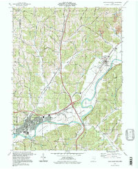
1994 Map of Newcomerstown
USGS Topo · Published 1998About this map
The Tuscarawas River carves a wide path through this portion of Tuscarawas County, defining the geography of Port Washington and the eastern edge of Newcomerstown. The landscape is a mix of broad floodplains like Nugent Bottom and steep, family-named ridges such as Stocker Ridge and Moores Hill. These highlands are marked by distinctive geological features including Umbrella Rock and Elephant Knob. The map highlights a long history of settlement and land tenure, evidenced by the Stark Patent and numerous rural religious sites such as Wolf Salem Ch and Mt Zion Cem.
Find a feature on this map
55 named features on this map. Tap any name to fly to it.
Don’t see what you’re looking for? This feature index may not catch every label — zoom into the map to look around manually.
Map Details
Editions of this 1994 Newcomerstown Map
This is the sole edition of this map. No revisions or reprints were ever made.
Other maps of this area

1909 · Antrim
USGS Topo · 1:48,000

1909 · Uhrichsville
USGS Topo · 1:62,500

1909 · Cambridge
USGS Topo · 1:62,500

1911 · Antrim
USGS Topo · 1:62,500

1911 · Uhrichsville
USGS Topo · 1:62,500

1911 · Newcomerstown
USGS Topo · 1:62,500

1912 · Cambridge
USGS Topo · 1:62,500

1913 · Newcomerstown
USGS Topo · 1:62,500

1943 · Newcomerstown
USGS Topo · 1:62,500

1951 · Canton
USGS Topo · 1:250,000