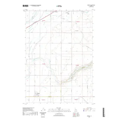
2020 Map of Newdale
USGS Topo · Published 2020About this map
Newdale and Chester anchor this agricultural landscape in the Upper Snake River Valley, where a complex network of man-made waterways supports the regional economy. The intricate irrigation system is defined by features such as the Fall River Canal, Enterprise Canal, and Crosscut Canal, which redirect water from the Fall River and Teton River across the volcanic plains. This modern survey reflects the enduring importance of water rights and land management in Idaho's potato-growing country. Away from the irrigated fields, the terrain rises into the distinctive Hog Hollow area, while local heritage is preserved at the Chester Cem and 800 North. The map traces the transition from the river bottomlands to the elevated benchlands, providing a clear record of the intersection between natural hydrology and the engineering required to sustain these rural communities.
Find a feature on this map
44 named features on this map. Tap any name to fly to it.
Don’t see what you’re looking for? This feature index may not catch every label — zoom into the map to look around manually.
Map Details
Editions of this 2020 Newdale Map
This is the sole edition of this map. No revisions or reprints were ever made.
Other maps of this area

1949 · Newdale
USGS Topo · 1:24,000

1950 · Newdale
USGS Topo · 1:24,000

1950 · St Anthony
USGS Topo · 1:24,000

1951 · Moody
USGS Topo · 1:24,000

1951 · White Owl Butte
USGS Topo · 1:24,000

1955 · Ashton
USGS Topo · 1:250,000

1955 · Driggs
USGS Topo · 1:250,000

1958 · Driggs
USGS Topo · 1:250,000

1958 · Ashton
USGS Topo · 1:250,000

1960 · Ashton
USGS Topo · 1:250,000