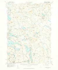
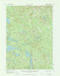
1958 Map of Newfield
USGS Topo · Published 1961About this map
The Little Ossipee River and its numerous glacial ponds define this mid-century landscape along the border of Maine and New Hampshire. Centered on the town of Newfield, the area is characterized by a high density of small village centers and crossroads including East Parsonsfield, Limerick, and Shapleigh. The map illustrates a developed rural economy with a heavy emphasis on water resources, featuring prominent bodies such as Great East Lake, Square Pond, and Sokokis Lake.
Find a feature on this map
192 named features on this map. Tap any name to fly to it.
Don’t see what you’re looking for? This feature index may not catch every label — zoom into the map to look around manually.
Map Details
Editions of this 1958 Newfield Map
5 editions found
Other maps of this area

1891 · Berwick
USGS Topo · 1:62,500

1891 · Kennebunk
USGS Topo · 1:62,500

1891 · Buxton
USGS Topo · 1:62,500

1891 · Newfield
USGS Topo · 1:62,500

1892 · Buxton
USGS Topo · 1:62,500

1893 · Kennebunk
USGS Topo · 1:62,500

1893 · Berwick
USGS Topo · 1:62,500

1893 · Buxton
USGS Topo · 1:62,500

1893 · Newfield
USGS Topo · 1:62,500

1896 · Sebago
USGS Topo · 1:62,500