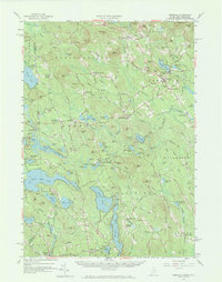
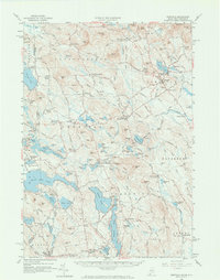
1958 Map of Newfield
USGS Topo · Published 1973About this map
The Salmon Falls River marks the boundary between New Hampshire and Maine in this late-1950s study of York and Carroll counties. The landscape is defined by its deep interconnected waters, including Great East Lake, Square Pond, and Province Lake, which anchor several small resort and agricultural communities. Local industry and social centers are well-documented, from the Gaging Station and Ski Area near Bond Mountain to small hamlets like Limerick Mills and Ossipee Mills.
Find a feature on this map
141 named features on this map. Tap any name to fly to it.
Don’t see what you’re looking for? This feature index may not catch every label — zoom into the map to look around manually.
Map Details
Editions of this 1958 Newfield Map
5 editions found
Other maps of this area

1891 · Berwick
USGS Topo · 1:62,500

1891 · Kennebunk
USGS Topo · 1:62,500

1891 · Buxton
USGS Topo · 1:62,500

1891 · Newfield
USGS Topo · 1:62,500

1892 · Buxton
USGS Topo · 1:62,500

1893 · Kennebunk
USGS Topo · 1:62,500

1893 · Berwick
USGS Topo · 1:62,500

1893 · Buxton
USGS Topo · 1:62,500

1893 · Newfield
USGS Topo · 1:62,500

1896 · Sebago
USGS Topo · 1:62,500