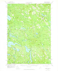
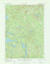
1958 Map of Newfield
USGS Topo · Published 1965About this map
Province Lake and Great East Lake straddle the border between Maine and New Hampshire, anchoring a landscape defined by glacial ponds and small village centers. In the late 1950s, this region of York County was characterized by a dense network of local roads and family-named corners such as Mee Corners and Stevens Corner. The presence of Limerick Mills and Ossipee Mills indicates the historical importance of water power along the local drainages, while the Bond Ski Mtn Area near Mitchell Mtn signals the mid-century development of seasonal recreation.
Find a feature on this map
164 named features on this map. Tap any name to fly to it.
Don’t see what you’re looking for? This feature index may not catch every label — zoom into the map to look around manually.
Map Details
Editions of this 1958 Newfield Map
5 editions found
Other maps of this area

1891 · Berwick
USGS Topo · 1:62,500

1891 · Kennebunk
USGS Topo · 1:62,500

1891 · Buxton
USGS Topo · 1:62,500

1891 · Newfield
USGS Topo · 1:62,500

1892 · Buxton
USGS Topo · 1:62,500

1893 · Kennebunk
USGS Topo · 1:62,500

1893 · Berwick
USGS Topo · 1:62,500

1893 · Buxton
USGS Topo · 1:62,500

1893 · Newfield
USGS Topo · 1:62,500

1896 · Sebago
USGS Topo · 1:62,500