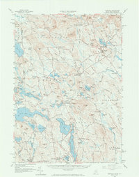
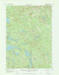
1958 Map of Newfield
USGS Topo · Published 1973About this map
Milton Mills and Limerick Mills anchor this mid-century portrait of the York County borderlands, where the landscape is defined by the winding Little River and the significant water bodies of Mousam Lake and Great East Lake. The area's mid-century character is reflected in its infrastructure, featuring a Gaging Station and a Radio Range Station south of Hussey Hill. The map meticulously records the rural fabric of the 1950s, showing numerous crossroads such as Mee Corners and Stevens Corner, along with localized landmarks like the Shapleigh Mem Sch and the Spinney Ch. A Ski Area near Bond Mtn suggests the emergence of modern recreation alongside traditional village life. This terrain, characterized by prominent ridges like Fort Ridge and Ballard Ridge, provided a backdrop for dispersed settlements from South Parsonsfield to North Alfred, many connected by historic routes like Acton Ridge Road and the Ross Corner-Alfred Road.
Find a feature on this map
202 named features on this map. Tap any name to fly to it.
Don’t see what you’re looking for? This feature index may not catch every label — zoom into the map to look around manually.
Map Details
Editions of this 1958 Newfield Map
5 editions found
Other maps of this area

1891 · Berwick
USGS Topo · 1:62,500

1891 · Kennebunk
USGS Topo · 1:62,500

1891 · Buxton
USGS Topo · 1:62,500

1891 · Newfield
USGS Topo · 1:62,500

1892 · Buxton
USGS Topo · 1:62,500

1893 · Kennebunk
USGS Topo · 1:62,500

1893 · Berwick
USGS Topo · 1:62,500

1893 · Buxton
USGS Topo · 1:62,500

1893 · Newfield
USGS Topo · 1:62,500

1896 · Sebago
USGS Topo · 1:62,500