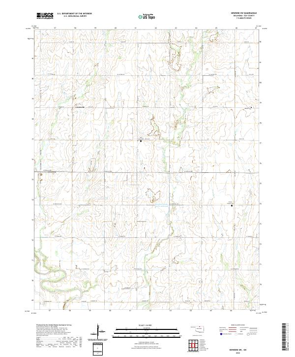
2022 Map of Newkirk SW
USGS Topo · Published 2022About this map
Grainville sits at the intersection of W Brake Rd and N R St, serving as a central point in this agricultural section of Kay County. The landscape is structured by the Public Land Survey System, with a precise grid of section lines and roads such as W Doolin Ave and W Hubbard Rd carving through the prairie. Water management is a visible priority in the terrain, evidenced by the Lost Duck Creeks Site D-1 Reservoir and the winding paths of Duck Cr and Lost Cr. For those researching local heritage, the map identifies several significant burial sites, including Banner Cem in the northeast and Saint Johns Cem near the center of the quadrangle. The presence of the Indian Meridian Tl along the western edge serves as a reminder of the foundational surveying lines that organized this part of Oklahoma.
Find a feature on this map
48 named features on this map. Tap any name to fly to it.
Don’t see what you’re looking for? This feature index may not catch every label — zoom into the map to look around manually.
Map Details
Editions of this 2022 Newkirk SW Map
This is the sole edition of this map. No revisions or reprints were ever made.
Other maps of this area

1955 · Enid
USGS Topo · 1:250,000

1958 · Enid
USGS Topo · 1:250,000

1967 · Braman
USGS Topo · 1:24,000

1968 · Ponca City NW
USGS Topo · 1:24,000
1968 · Newkirk
USGS Topo · 1:24,000

1968 · Tonkawa
USGS Topo · 1:24,000

1968 · Kildare
USGS Topo · 1:24,000

1968 · Blackwell
USGS Topo · 1:24,000
1968 · Newkirk SW
USGS Topo · 1:24,000
1968 · Peckham
USGS Topo · 1:24,000