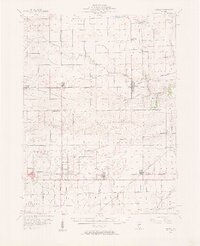
1956 Map of Newman
USGS Topo · Published 1957About this map
The agricultural plains of East Central Illinois are defined by an orderly grid of roads and railroads in this mid-century survey. Newman and Sidell serve as significant hubs where the Baltimore and Ohio and Chicago and Eastern Illinois railroads intersect the landscape. The map captures a transition in local education, showing the Jamaica High Sch alongside the already Miller Sch (Abandoned), documenting the consolidation of rural school districts. Small agrarian communities like Hume, Metcalf, and Broadlands are clearly delineated, often clustered around rail sidings and grain elevators. Waterways such as the Little Vermilion River and the East Branch Embarrass River cut through the townships of Young America and Sargent, providing a natural contrast to the surveyed section lines. Local genealogy is well-served by the inclusion of the Lost Grove Cem and rural houses of worship like Fairfield Ch.
Find a feature on this map
47 named features on this map. Tap any name to fly to it.
Don’t see what you’re looking for? This feature index may not catch every label — zoom into the map to look around manually.
Map Details
Editions of this 1956 Newman Map
2 editions found

Other maps of this area

1899 · Danville
USGS Topo · 1:62,500

1900 · Danville
USGS Topo · 1:62,500

1906 · Urbana
USGS Topo · 1:62,500

1931 · Fithian
USGS Topo · 1:48,000

1936 · Oakland
USGS Topo · 1:48,000

1942 · Oakland
USGS Topo · 1:62,500

1943 · Fithian
USGS Topo · 1:62,500

1946 · Kansas
USGS Topo · 1:62,500

1947 · Ridge Farm
USGS Topo · 1:62,500

1947 · Paris
USGS Topo · 1:62,500