
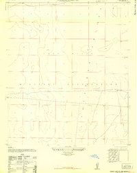
1948 Map of Newman NW
USGS Topo · Published 1948About this map
The Fort Bliss Military Reservation dominates this 1948 topographic study of the high desert terrain north of the Texas-New Mexico border. This military edition, later reprinted for civil use, reveals a landscape defined by arroyos and defensive topography, where the eastern slopes of the Organ Mountains descend into the plains. Scattered across this arid expanse are essential water features like Old Coe Lake, Scott Tank, and Pit Tank, which provided vital resources for both livestock and military operations in the pre-interstate era. The presence of an Abandoned Road cutting across the central grid suggests shifting transportation patterns as the military installation expanded and reorganized its boundaries. Isolated peaks such as Deer Hill and the Black Hills provide distinct navigational landmarks against the otherwise uniform desert floor.
Find a feature on this map
8 named features on this map. Tap any name to fly to it.
Don’t see what you’re looking for? This feature index may not catch every label — zoom into the map to look around manually.
Map Details
Editions of this 1948 Newman NW Map
This is the sole edition of this map. No revisions or reprints were ever made.
Other maps of this area

1891 · Las Cruces
USGS Topo · 1:125,000

1893 · Las Cruces
USGS Topo · 1:125,000

1940 · Newman
USGS Topo · 1:62,500

1941 · Organ Peak
USGS Topo · 1:62,500

1943 · La Mesa
USGS Topo · 1:62,500

1943 · Parker Lake
USGS Topo · 1:62,500

1943 · Newman
USGS Topo · 1:62,500

1943 · Organ Peak
USGS Topo · 1:62,500

1948 · Davies Tank
USGS Topo · 1:24,000
1948 · Parker Lake SE
USGS Topo · 1:24,000