
1964 Map of Newport
USGS Topo · Published 1965About this map
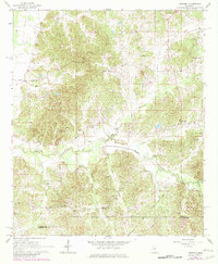
Newport sits at the heart of this mid-1960s landscape, where the rural topography of the Attala Co Madison Co border is defined by a dense network of creek drainages and small community landmarks. The map documents an area deeply rooted in local history, featuring the Old Indian Boundary slicing across the terrain and an Old Railroad Grade tracing a former transportation corridor. The settlement pattern is largely ecclesiastical and familial, evidenced by numerous country churches such as New Canyon Ch and Spring Grove Ch, alongside family-named burial grounds like Dickerson Cem and Wyatt Cem. A prominent Sallis Lookout Tower overlooks the wooded ridges, while the winding course of Seneasha Creek and its tributaries like Bolanlusha Creek carve through the agricultural and timbered lands of central Mississippi.
Find a feature on this map
39 named features on this map. Tap any name to fly to it.
Don’t see what you’re looking for? This feature index may not catch every label — zoom into the map to look around manually.
Map Details
Editions of this 1964 Newport Map
2 editions found
Other maps of this area

1953 · Meridian
USGS Topo · 1:250,000

1953 · West Point
USGS Topo · 1:250,000

1957 · Meridian
USGS Topo · 1:250,000

1958 · West Point
USGS Topo · 1:250,000

1962 · Thomastown
USGS Topo · 1:62,500

1963 · West Point
USGS Topo · 1:250,000

1964 · Camden
USGS Topo · 1:24,000
1964 · Durant
USGS Topo · 1:24,000
1964 · Owens Wells
USGS Topo · 1:24,000
1964 · McAdams
USGS Topo · 1:24,000