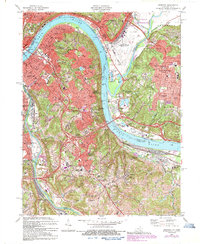
1983 Map of Newport
USGS Topo · Published 1987About this map
The Ohio River curves sharply through this region, forming the northern border of Campbell County and separating the industrial and residential hubs of Newport and Covington from Cincinnati. This late-century survey captures a densely developed riverfront corridor where major rail lines like the C & O RR and L & N RR parallel the water's edge, supporting the growth of hillside communities like Dayton, Bellevue, and Fort Thomas.
Find a feature on this map
103 named features on this map. Tap any name to fly to it.
Don’t see what you’re looking for? This feature index may not catch every label — zoom into the map to look around manually.
Map Details
Editions of this 1983 Newport Map
2 editions found
Other maps of this area

1898 · East Cincinnati
USGS Topo · 1:62,500

1914 · East Cincinnati
USGS Topo · 1:62,500

1914 · West Cincinnati
USGS Topo · 1:62,500

1929 · Alexandria
USGS Topo · 1:48,000

1936 · Alexandria
USGS Topo · 1:62,500

1950 · Independence
USGS Topo · 1:24,000

1950 · Covington
USGS Topo · 1:24,000

1952 · Newport
USGS Topo · 1:24,000

1953 · Withamsville
USGS Topo · 1:24,000

1953 · New Richmond
USGS Topo · 1:24,000