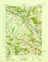
1945 Map of Newport
USGS Topo · Published 1945About this map
West Canada Creek dictates the geography of this 1940s landscape, winding through a valley that connects the industrial and agricultural hubs of Poland and Newport. Along the New York Central railroad corridor, the map reveals a mid-century rural economy anchored by family-named landmarks and local institutions. Significant for genealogists, the survey identifies numerous crossroads and hill settlements, including the Irish Settlement in the south and various named corners such as Walker Corners and Brayton Corners.
Find a feature on this map
56 named features on this map. Tap any name to fly to it.
Don’t see what you’re looking for? This feature index may not catch every label — zoom into the map to look around manually.
Map Details
Editions of this 1945 Newport Map
This is the sole edition of this map. No revisions or reprints were ever made.
Other maps of this area

1897 · Remsen
USGS Topo · 1:62,500

1898 · Utica
USGS Topo · 1:62,500

1900 · Little Falls
USGS Topo · 1:62,500

1900 · Utica
USGS Topo · 1:62,500

1900 · Remsen
USGS Topo · 1:62,500

1900 · Wilmurt
USGS Topo · 1:62,500

1902 · Wilmurt
USGS Topo · 1:62,500

1903 · Little Falls
USGS Topo · 1:62,500

1939 · Little Falls
USGS Topo · 1:62,500

1943 · Newport
USGS Topo · 1:24,000