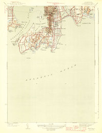
1944 Map of Newport
USGS Topo · Published 1944About this map
The coastal fortifications of Narragansett Bay dominate the landscape in this 1939 survey, reflecting the strategic maritime importance of Newport during the Second World War era. From the massive footprint of Fort Adams on Brenton Cove to the outlying defenses of Fort Wetherill and Fort Hamilton, the map details a region defined by its naval and military presence. Further inland, the city's residential and civic character is preserved through the locations of the Island Cem, Common Ground Cem, and several educational institutions including De La Salle Academy and Rogers High Sch. The southern peninsula, home to the Newport Country Club, showcases a rugged coastline dotted with geographic landmarks like Spouting Rock and Gooseberry I, while the eastern shore transition toward Middletown highlights the large freshwater bodies of Easton Pond and Gardiner Pond.
Find a feature on this map
62 named features on this map. Tap any name to fly to it.
Don’t see what you’re looking for? This feature index may not catch every label — zoom into the map to look around manually.
Map Details
Editions of this 1944 Newport Map
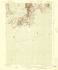
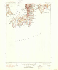
3 editions found
Other maps of this area

1885 · Sakonnet
USGS Topo · 1:62,500

1888 · Fall River
USGS Topo · 1:62,500

1888 · Sakonnet
USGS Topo · 1:62,500

1889 · Newport
USGS Topo · 1:62,500

1890 · Narragansett Bay
USGS Topo · 1:62,500

1892 · Narragansett Bay
USGS Topo · 1:62,500

1893 · Sakonnet
USGS Topo · 1:62,500

1893 · Fall River
USGS Topo · 1:62,500

1894 · Newport
USGS Topo · 1:62,500

1904 · Newport
USGS Topo · 1:62,500