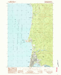
1984 Map of Newport North
USGS Topo · Published 1985About this map
Yaquina Head stands as a prominent coastal landmark on this 1980s survey, home to a light house and the Yaquina Pt. Latitude Sta. along the central Oregon coast. The map details the northern expansion of Newport and its surrounding communities, including Agate Beach, Newport Heights, and Beverly Beach. This era shows a landscape where public recreation and maritime safety intersect, documented through numerous coastal preserves like Devils Punch Bowl State Park and the offshore Oregon Islands National Wildlife Refuge Wilderness. Inland, the terrain is defined by the drainages of Big Creek and Moolack Creek, with water infrastructure including Big Cr Reservoir No 1. Local institutional history is captured through the presence of the Eureka Cem, Yaquina View Sch, and the city's civic core featuring the Armory and City Hall near the northern edge of Yaquina Bay.
Find a feature on this map
63 named features on this map. Tap any name to fly to it.
Don’t see what you’re looking for? This feature index may not catch every label — zoom into the map to look around manually.
Map Details
Editions of this 1984 Newport North Map
2 editions found
Other maps of this area

1941 · Cape Foulweather
USGS Topo · 1:62,500

1942 · Euchre Mtn
USGS Topo · 1:62,500

1942 · Yaquina
USGS Topo · 1:62,500

1942 · Toledo
USGS Topo · 1:62,500

1943 · Euchre Mtn
USGS Topo · 1:62,500

1944 · Cape Foulweather
USGS Topo · 1:62,500

1953 · Salem
USGS Topo · 1:250,000

1954 · Salem
USGS Topo · 1:250,000

1957 · Cape Foulweather
USGS Topo · 1:62,500

1957 · Yaquina
USGS Topo · 1:62,500