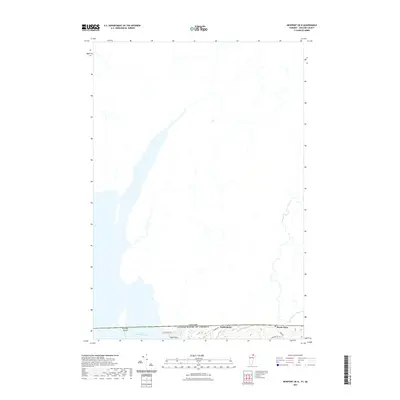
2021 Map of Newport OE N
USGS Topo · Published 2021About this map
Lake Memphremagog dominates the southern landscape of this international border survey, where the waters cross from the United States into Canada. The border line itself, labeled Canada United States of America, bisects several prominent features including Province Island and the small settlement of Beebe Plain. The map details the rural character of the region just north of Newport, Vermont, showing the winding course of the Johns River as it approaches the lake. Along the eastern edge, Beebe Rd and Darling Hill Rd provide access to the dispersed lakeside community. Further west, Eagle Point and North Derby mark localized points of settlement along the shoreline and inland roads, illustrating the proximity of these communities to the international boundary line in the early twenty-first century.
Find a feature on this map
11 named features on this map. Tap any name to fly to it.
Don’t see what you’re looking for? This feature index may not catch every label — zoom into the map to look around manually.
Map Details
Editions of this 2021 Newport OE N Map
This is the sole edition of this map. No revisions or reprints were ever made.
Other maps of this area

1919 · Lake Memphremagog
USGS Topo · 1:62,500

1920 · Derby
USGS Topo · 1:62,500

1920 · Irasburg
USGS Topo · 1:62,500

1923 · Irasburg
USGS Topo · 1:48,000

1923 · Lake Memphremagog
USGS Topo · 1:48,000

1925 · Irasburg
USGS Topo · 1:62,500

1925 · Memphremagog
USGS Topo · 1:62,500

1950 · Lake Champlain
USGS Topo · 1:250,000

1953 · Irasburg
USGS Topo · 1:62,500
1953 · Memphremagog
USGS Topo · 1:62,500