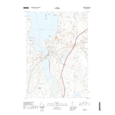
2021 Map of Newport
USGS Topo · Published 2021About this map
Lake Memphremagog dominates the northern landscape of this Vermont region, with Newport situated where the Black River and Clyde River meet at the water's edge. The industrial heritage of the area is noted by the presence of the Bobbin Mill near the town center, while the broader geography includes the expanding Northeast Kingdom International Airport to the south. The terrain is defined by a series of prominent rises including Shattuck Hill, Salem Hill, and Darling Hill, which overlook the interconnected waterways of South Bay and Clyde Pond. Local genealogy is well-represented through numerous burial grounds such as Saint Marys Cem, Morrill-Darling Hill Cem, and the Mitchell-Derusha Cem. The proximity to the international border is implied by the vast reach of the lake and the cluster of settlements including Derby Center and Orleans, connected by a network of established roads like W Charleston Rd and Beebe Rd.
Find a feature on this map
119 named features on this map. Tap any name to fly to it.
Don’t see what you’re looking for? This feature index may not catch every label — zoom into the map to look around manually.
Map Details
Editions of this 2021 Newport Map
This is the sole edition of this map. No revisions or reprints were ever made.
Other maps of this area

1919 · Lake Memphremagog
USGS Topo · 1:62,500

1920 · Derby
USGS Topo · 1:62,500

1920 · Irasburg
USGS Topo · 1:62,500

1923 · Irasburg
USGS Topo · 1:48,000

1923 · Lake Memphremagog
USGS Topo · 1:48,000

1925 · Irasburg
USGS Topo · 1:62,500

1925 · Memphremagog
USGS Topo · 1:62,500

1950 · Lake Champlain
USGS Topo · 1:250,000

1953 · Irasburg
USGS Topo · 1:62,500
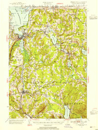
1953 · Memphremagog
USGS Topo · 1:62,500