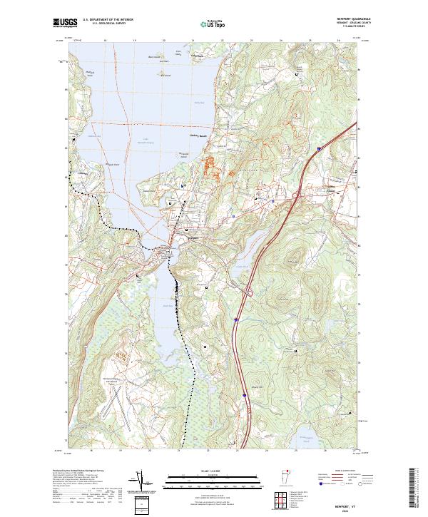
2024 Map of Newport
USGS Topo · Published 2024About this map
Newport sits at the southern reach of Lake Memphremagog, where the Black River and Barton River feed into South Bay. This modern topographic landscape is defined by the convergence of water and travel, featuring the Northern Forest Canoe Trail alongside the converted Beebe Spur Rail-Trail. The area between the city and Derby Center is marked by significant civic infrastructure, including the Orleans County Courthouse and the Northeast Kingdom International Airport.
Find a feature on this map
50 named features on this map. Tap any name to fly to it.
Don’t see what you’re looking for? This feature index may not catch every label — zoom into the map to look around manually.
Map Details
Editions of this 2024 Newport Map
This is the sole edition of this map. No revisions or reprints were ever made.
Other maps of this area

1919 · Lake Memphremagog
USGS Topo · 1:62,500

1920 · Derby
USGS Topo · 1:62,500

1920 · Irasburg
USGS Topo · 1:62,500

1923 · Irasburg
USGS Topo · 1:48,000

1923 · Lake Memphremagog
USGS Topo · 1:48,000

1925 · Irasburg
USGS Topo · 1:62,500

1925 · Memphremagog
USGS Topo · 1:62,500

1950 · Lake Champlain
USGS Topo · 1:250,000

1953 · Irasburg
USGS Topo · 1:62,500
1953 · Memphremagog
USGS Topo · 1:62,500