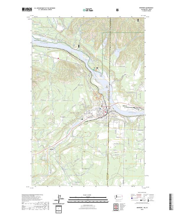
2023 Map of Newport
USGS Topo · Published 2023About this map
The Pend Oreille River serves as the central artery of this region, separating Newport on the Washington side from Oldtown in Idaho. This interstate connection is anchored by the Pend Oreille County Courthouse and educational institutions like the Colleges of Spokane Newport Center. The landscape is a mix of municipal development and protected timberlands within the Kaniksu National Forest, which covers the northern reaches of the map.
Find a feature on this map
138 named features on this map. Tap any name to fly to it.
Don’t see what you’re looking for? This feature index may not catch every label — zoom into the map to look around manually.
Map Details
Editions of this 2023 Newport Map
This is the sole edition of this map. No revisions or reprints were ever made.
Other maps of this area

1901 · Sandpoint
USGS Topo · 1:125,000

1911 · Priest Lake
USGS Topo · 1:250,000

1911 · Sandpoint
USGS Topo · 1:125,000

1913 · Priest Lake
USGS Topo · 1:250,000

1936 · Newport
USGS Topo · 1:96,000

1942 · Newport
USGS Topo · 1:125,000

1958 · Sandpoint
USGS Topo · 1:250,000

1963 · Sandpoint
USGS Topo · 1:250,000

1967 · Quartz Mtn
USGS Topo · 1:24,000
1968 · Blanchard
USGS Topo · 1:24,000