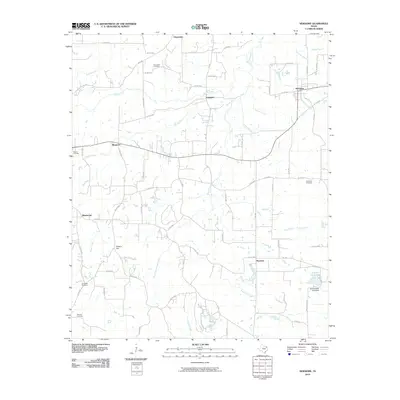
2010 Map of Newsome
USGS Topo · Published 2010About this map
Newsome and Scroggins anchor this 2010 topographic study of the East Texas landscape, where small rural communities are connected by a dense network of Farm to Market roads and county routes. The terrain is defined by its hydrology, featuring the branching drainages of Brushy Creek, South Fork Brushy Creek, and South Lilly Creek. This area maintains its traditional rural character, evidenced by the numerous family and community burial grounds such as Clearwater Cemetery, Hepsibah Cemetery, and Monday Cemetery. Toward the southeast, the Elwood Club Lake Dam and the waters of Elwood Club Lake indicate a focus on recreational land use amid the creek bottoms. Notable elevations like Stivers Hill provide contrast to the numerous winding branches, including North Lilly Creek and Caney Creek, which shape the local geography.
Find a feature on this map
80 named features on this map. Tap any name to fly to it.
Don’t see what you’re looking for? This feature index may not catch every label — zoom into the map to look around manually.
Map Details
Editions of this 2010 Newsome Map
This is the sole edition of this map. No revisions or reprints were ever made.
Other maps of this area

1953 · Texarkana
USGS Topo · 1:250,000

1956 · Texarkana
USGS Topo · 1:250,000

1956 · Tyler
USGS Topo · 1:250,000

1960 · Winnsboro
USGS Topo · 1:24,000

1960 · Cartwright
USGS Topo · 1:24,000

1960 · Thomas
USGS Topo · 1:24,000

1960 · Newsome
USGS Topo · 1:24,000

1960 · Leesburg
USGS Topo · 1:24,000

1960 · Rhonesboro
USGS Topo · 1:24,000

1964 · Purley
USGS Topo · 1:24,000