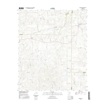
2016 Map of Newsome
USGS Topo · Published 2016About this map
Scroggins and Newsome sit at the intersection of a complex drainage network in East Texas, where the terrain is defined by the headwaters of numerous creeks and branches. This 2016 survey highlights the agrarian and rural residential patterns of Wood and Camp Counties, centered around the Pineview community. The landscape is deeply incised by watercourses such as Brushy Cr, S Fork Brushy Cr, and N Lilly Cr, which dictate the winding paths of the local county road system. Genealogists will find significant value in the distribution of family-oriented landmarks, including Clearwater Cem, Willard Cem, and Hepsibah Cem. The map also captures local geographical points like Stivers Hill and water bodies such as Shiners Pond and Elwood Club Lake, reflecting the persistent rural character of the region as it transitions between the small settlements of Musgrove and Scroggins.
Find a feature on this map
112 named features on this map. Tap any name to fly to it.
Don’t see what you’re looking for? This feature index may not catch every label — zoom into the map to look around manually.
Map Details
Editions of this 2016 Newsome Map
This is the sole edition of this map. No revisions or reprints were ever made.
Other maps of this area

1953 · Texarkana
USGS Topo · 1:250,000

1956 · Texarkana
USGS Topo · 1:250,000

1956 · Tyler
USGS Topo · 1:250,000

1960 · Winnsboro
USGS Topo · 1:24,000

1960 · Cartwright
USGS Topo · 1:24,000

1960 · Thomas
USGS Topo · 1:24,000

1960 · Newsome
USGS Topo · 1:24,000

1960 · Leesburg
USGS Topo · 1:24,000

1960 · Rhonesboro
USGS Topo · 1:24,000

1964 · Purley
USGS Topo · 1:24,000