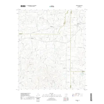
2019 Map of Newsome
USGS Topo · Published 2019About this map
Newsome and Scroggins sit at the northern edge of this Wood County landscape, where the local terrain is defined by the headwaters of numerous creeks. This area, spanning the borders of Wood, Franklin, Camp, and Upshur counties, shows a dispersed rural settlement pattern organized around a dense network of county roads. Genealogical interest is centered on several community burial grounds, including Hepsibah Cem in the east and Monday Cem to the southwest. The topography is characterized by subtle rises like Stivers Hill and the drainage basins of S Lilly Cr and Brushy Cr. Further south, the community of Pineview is located near the Elwood Club Lake, reflecting the local importance of small water impoundments and timber-lined creek bottoms in this part of East Texas.
Find a feature on this map
117 named features on this map. Tap any name to fly to it.
Don’t see what you’re looking for? This feature index may not catch every label — zoom into the map to look around manually.
Map Details
Editions of this 2019 Newsome Map
This is the sole edition of this map. No revisions or reprints were ever made.
Other maps of this area

1953 · Texarkana
USGS Topo · 1:250,000

1956 · Texarkana
USGS Topo · 1:250,000

1956 · Tyler
USGS Topo · 1:250,000

1960 · Winnsboro
USGS Topo · 1:24,000

1960 · Cartwright
USGS Topo · 1:24,000

1960 · Thomas
USGS Topo · 1:24,000

1960 · Newsome
USGS Topo · 1:24,000

1960 · Leesburg
USGS Topo · 1:24,000

1960 · Rhonesboro
USGS Topo · 1:24,000

1964 · Purley
USGS Topo · 1:24,000