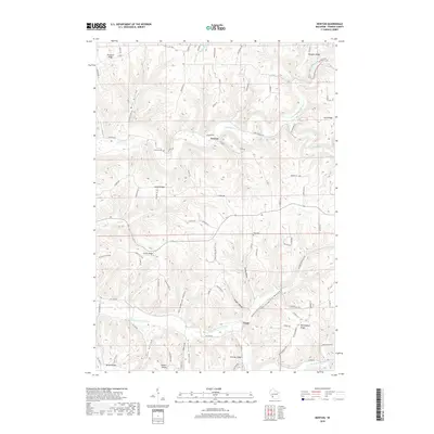
2018 Map of Newton
USGS Topo · Published 2018About this map
The unincorporated settlements of Newton and Purdy anchor this part of Vernon County, positioned within a landscape defined by the branching tributaries of the Bad Axe River. The terrain is characterized by a series of prominent ridges and deep hollows, such as Nottingham Ridge and the extensive Norwegian Hollow, which historically dictated the pattern of travel and settlement in the region. Agricultural activity and rural life are centered around these high points, with roads like Irish Ridge Rd following the crests of the land. Small local landmarks like Haukley Cem and Zion Cem provide specific points of interest for genealogists tracing families in the driftless area. The drainage of the N Fork Bad Axe River and S Fork Bad Axe River create a complex system of valleys, including Frohock Valley and Purdy Valley, that reveal the underlying geological structure of the Wisconsin countryside.
Find a feature on this map
87 named features on this map. Tap any name to fly to it.
Don’t see what you’re looking for? This feature index may not catch every label — zoom into the map to look around manually.
Map Details
Editions of this 2018 Newton Map
This is the sole edition of this map. No revisions or reprints were ever made.
Other maps of this area

1903 · Waukon
USGS Topo · 1:125,000

1923 · Viroqua
USGS Topo · 1:62,500

1924 · Gays Mills
USGS Topo · 1:62,500

1926 · Gays Mills
USGS Topo · 1:62,500

1926 · Stoddard
USGS Topo · 1:62,500

1926 · Viroqua
USGS Topo · 1:62,500

1929 · Ferryville
USGS Topo · 1:62,500

1932 · Ferryville
USGS Topo · 1:62,500

1958 · La Crosse
USGS Topo · 1:250,000

1961 · La Crosse
USGS Topo · 1:250,000