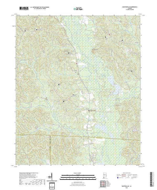
2024 Map of Newtonville
USGS Topo · Published 2024About this map
Newtonville serves as the central settlement in this area of West Alabama, situated near the intersection of several county roads where the borders of Fayette, Pickens, and Tuscaloosa counties meet. The landscape is defined by the winding course of the Sipsey River, which flows through a network of creeks and branches including Savage Creek, Davis Creek, and Bear Creek. Notable elevations like McCracken Mtn and Savage Mtn rise above the river valley, marking the local topography.
Find a feature on this map
73 named features on this map. Tap any name to fly to it.
Don’t see what you’re looking for? This feature index may not catch every label — zoom into the map to look around manually.
Map Details
Editions of this 2024 Newtonville Map
This is the sole edition of this map. No revisions or reprints were ever made.
Other maps of this area

1926 · Samantha
USGS Topo · 1:48,000

1928 · Samantha
USGS Topo · 1:62,500

1953 · Birmingham
USGS Topo · 1:250,000

1956 · Birmingham
USGS Topo · 1:250,000

1957 · Birmingham
USGS Topo · 1:250,000

1967 · Brownville
USGS Topo · 1:24,000

1967 · Bankston
USGS Topo · 1:24,000

1967 · Newtonville
USGS Topo · 1:24,000

1967 · Kennedy
USGS Topo · 1:24,000

1967 · Fayette
USGS Topo · 1:24,000