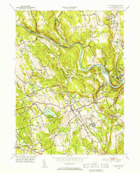
1953 Map of Newtown
USGS Topo · Published 1955About this map
The Housatonic River winds through this mid-century landscape, forming the natural boundary between the towns of Brookfield, Bridgewater, and Southbury. In the southern portion of the quadrangle, the town of Newtown serves as a central hub for the region's transportation and institutional life. The extensive grounds of the Fairfield State Hospital and the Southbury Training Sch highlight the era's focus on large-scale public health and educational facilities.
Find a feature on this map
80 named features on this map. Tap any name to fly to it.
Don’t see what you’re looking for? This feature index may not catch every label — zoom into the map to look around manually.
Map Details
Editions of this 1953 Newtown Map
3 editions found
Other maps of this area

1889 · Derby
USGS Topo · 1:62,500

1891 · Derby
USGS Topo · 1:62,500

1892 · Danbury
USGS Topo · 1:62,500

1892 · New Milford
USGS Topo · 1:62,500

1893 · Waterbury
USGS Topo · 1:62,500

1893 · New Milford
USGS Topo · 1:62,500

1893 · Derby
USGS Topo · 1:62,500

1904 · New Milford
USGS Topo · 1:62,500

1904 · Waterbury
USGS Topo · 1:62,500

1904 · Litchfield
USGS Topo · 1:125,000