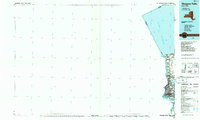
1986 Map of Niagara Falls
USGS Topo · Published 1986About this map
Old Fort Niagara stands at the mouth of the Niagara River, anchoring a 1986 landscape shaped by centuries of frontier defense and industrial utility. This planimetric study captures the international boundary between Ontario and Niagara County as it appeared in the mid-1980s, documenting the dense concentration of parks along the river corridor, including Fort Niagara State Park and Whirlpool State Park. The map highlights the sharp geological transition of the Niagara Escarpment and the heavy engineering of the Powerplant and various Substations that harness the falls. Beyond the primary urban core of Niagara Falls, the residential expansion into Youngstown Estates, Riverside Manors, and Blairville is clearly defined, while an Old Railroad Grade serves as a reminder of the region's evolving transportation network during this era of late-century development.
Find a feature on this map
38 named features on this map. Tap any name to fly to it.
Don’t see what you’re looking for? This feature index may not catch every label — zoom into the map to look around manually.
Map Details
Editions of this 1986 Niagara Falls Map
2 editions found
Other maps of this area

1894 · Buffalo
USGS Topo · 1:62,500

1894 · Niagara Falls
USGS Topo · 1:62,500

1894 · Wilson
USGS Topo · 1:62,500

1896 · Niagara Falls
USGS Topo · 1:62,500

1897 · Tonawanda
USGS Topo · 1:62,500

1899 · Niagara
USGS Topo · 1:125,000

1900 · Wilson
USGS Topo · 1:62,500

1900 · Tonawanda
USGS Topo · 1:62,500

1900 · Niagara Falls
USGS Topo · 1:62,500

1901 · Buffalo
USGS Topo · 1:62,500