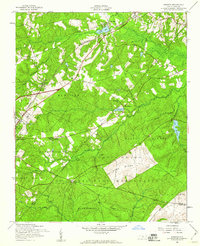
1957 Map of Niagara
USGS Topo · Published 1960About this map
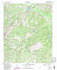
Fort Bragg Military Reservation dominates the southern landscape of this mid-century Moore County survey, with the high ground of Railroad Ridge and Sand Hill marking the transition into tactical training grounds. Further north, the influence of the Seaboard Air Line railroad is evident in the alignment of settlements including Niagara, Manly, and Vass. Local landmarks such as the Old Notre Dame Academy and Ranger Station No 2 provide specific points of interest for those tracking the institutional history of the region.
Find a feature on this map
36 named features on this map. Tap any name to fly to it.
Don’t see what you’re looking for? This feature index may not catch every label — zoom into the map to look around manually.
Map Details
Editions of this 1957 Niagara Map
5 editions found
Other maps of this area

1948 · Southern Pines
USGS Topo · 1:62,500

1948 · Clifdale
USGS Topo · 1:62,500

1948 · Pinebluff
USGS Topo · 1:24,000

1948 · Nicholson Creek
USGS Topo · 1:24,000

1948 · Mc Cain
USGS Topo · 1:24,000

1950 · Sanatorium
USGS Topo · 1:24,000

1950 · Lobelia
USGS Topo · 1:24,000

1950 · Pine Bluff
USGS Topo · 1:24,000

1950 · Niagara
USGS Topo · 1:24,000

1950 · Southern Pines
USGS Topo · 1:24,000