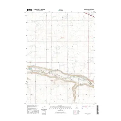
2017 Map of Niagara Springs
USGS Topo · Published 2017About this map
The Snake River carves a deep canyon through this landscape, serving as the boundary between Gooding Co and Twin Falls Co. Along its northern banks, the terrain is marked by significant spring activity at Niagara Springs and Crystal Springs, where the plateau drops precipitously to the riverbed via steep routes like the Niagara Springs Grade and Crystal Springs Grade. These features represent a critical geological and hydrologic transition in the region.
Find a feature on this map
38 named features on this map. Tap any name to fly to it.
Don’t see what you’re looking for? This feature index may not catch every label — zoom into the map to look around manually.
Map Details
Editions of this 2017 Niagara Springs Map
This is the sole edition of this map. No revisions or reprints were ever made.
Other maps of this area

1949 · Thousand Springs
USGS Topo · 1:24,000

1949 · Tuttle
USGS Topo · 1:24,000

1950 · Niagara Springs
USGS Topo · 1:24,000

1950 · Filer
USGS Topo · 1:24,000

1950 · Jerome
USGS Topo · 1:24,000

1950 · Jerome
USGS Topo · 1:62,500

1951 · Thousand Springs
USGS Topo · 1:24,000

1951 · Tuttle
USGS Topo · 1:24,000

1951 · Clover
USGS Topo · 1:24,000

1954 · Thousand Springs
USGS Topo · 1:24,000