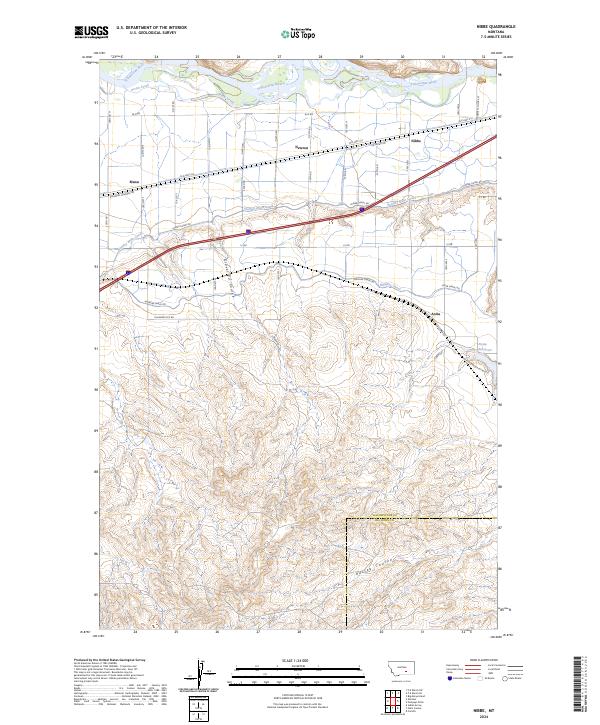
2024 Map of Nibbe
USGS Topo · Published 2024About this map
Pompeys Pillar National Monument stands as the primary landmark in this Montana landscape, situated along the northern bank of the Yellowstone River. The topography transitions from the river valley into a complex network of agricultural irrigation, defined by the Huntley Main Canal, Highline Canal, and Anita Reservoir. Small community hubs like Nibbe, Newton, and Mann are tied together by a infrastructure of roads such as Old Hwy 312 and Railroad Highway Rd, reflecting the area's development as a transport and farming corridor.
Find a feature on this map
51 named features on this map. Tap any name to fly to it.
Don’t see what you’re looking for? This feature index may not catch every label — zoom into the map to look around manually.
Map Details
Editions of this 2024 Nibbe Map
This is the sole edition of this map. No revisions or reprints were ever made.
Other maps of this area

1893 · Huntley
USGS Topo · 1:125,000

1894 · Fort Custer
USGS Topo · 1:125,000

1954 · Billings
USGS Topo · 1:250,000

1954 · Hardin
USGS Topo · 1:250,000

1954 · Forsyth
USGS Topo · 1:250,000

1954 · Roundup
USGS Topo · 1:250,000

1957 · Hardin
USGS Topo · 1:250,000

1957 · Forsyth
USGS Topo · 1:250,000

1957 · Billings
USGS Topo · 1:250,000

1958 · Billings
USGS Topo · 1:250,000