1971 Map of Nicholls
USGS Topo · Published 1988About this map
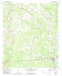
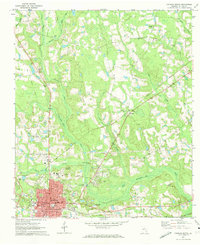
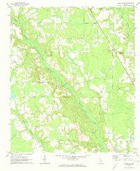
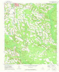
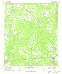
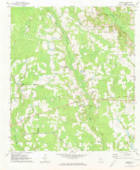
West Green and Nicholls anchor this South Georgia landscape, where the agricultural and transport patterns of the late twentieth century are clearly visible. The area is defined by its drainage systems, with Hurricane Creek, Otter Creek, and Bear Creek winding through a mosaic of woodland and cleared fields. The SCL railroad serves as a primary axis for the region, connecting the small community of Chatterton and the siding at Saginaw to the larger hub of Nicholls.
Find a feature on this map
21 named features on this map. Tap any name to fly to it.
Don’t see what you’re looking for? This feature index may not catch every label — zoom into the map to look around manually.
Map Details
Editions of this 1971 Nicholls Map
2 editions found
Other maps of this area

1953 · Waycross
USGS Topo · 1:250,000

1958 · Waycross
USGS Topo · 1:250,000
1971 · Douglas North
USGS Topo · 1:24,000
1971 · Nicholls NE
USGS Topo · 1:24,000
1971 · Douglas South
USGS Topo · 1:24,000
1971 · Nicholls
USGS Topo · 1:24,000
1971 · Wilsonville
USGS Topo · 1:24,000
1971 · Broxton NE
USGS Topo · 1:24,000
1971 · Beach
USGS Topo · 1:24,000
1971 · Sessoms
USGS Topo · 1:24,000