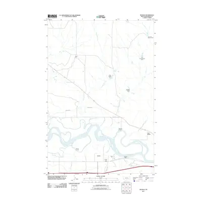
2011 Map of Nichols
USGS Topo · Published 2011About this map
The Yellowstone River snakes through the heart of this Rosebud County landscape, defining the agricultural and transit patterns of the Howard Valley region. Near the southern riverbanks, the small settlement of Nichols and the nearby Nichols Wye sit adjacent to the rail line and the Armells Creek Bridge. North of the river, the landscape is shaped by long-standing irrigation efforts, visible in the Hammond Canal and several water management structures such as the Montana Number 7 Dam and the Big Timber Number 1 Dam. The topography is characterized by deep drainage systems like Wyant Coulee and McGraw Coulee, which cut through the high ground. The presence of the Mardis Ranch to the north and the cluster at Cold Spring to the east illustrate the enduring ranching and rural residential character of this Montana valley.
Find a feature on this map
22 named features on this map. Tap any name to fly to it.
Don’t see what you’re looking for? This feature index may not catch every label — zoom into the map to look around manually.
Map Details
Editions of this 2011 Nichols Map
This is the sole edition of this map. No revisions or reprints were ever made.
Other maps of this area

1954 · Forsyth
USGS Topo · 1:250,000

1957 · Forsyth
USGS Topo · 1:250,000

1958 · Forsyth
USGS Topo · 1:250,000

1968 · Donleys Reservoir
USGS Topo · 1:24,000

1968 · Nichols
USGS Topo · 1:24,000

1968 · Forsyth
USGS Topo · 1:24,000

1968 · Finch NE
USGS Topo · 1:24,000

1968 · Black Coulee
USGS Topo · 1:24,000

1968 · Finch
USGS Topo · 1:24,000

1971 · Griffin Coulee NE
USGS Topo · 1:24,000